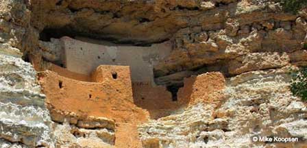
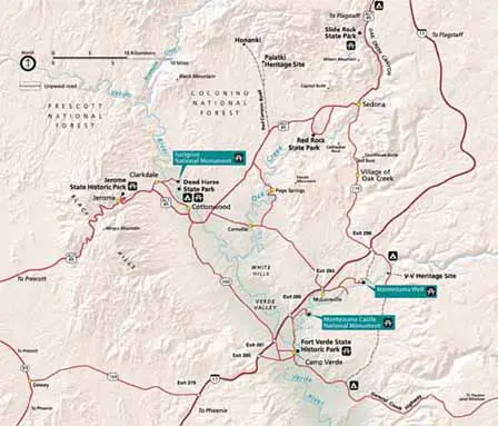
Map and Directions To Montezuma Castle National Monument


From Sedona. Take Highway 179 from Sedona to I-17 Freeway. South on I-17 to Exit 289 East and follow the signs for about 3 miles to the entrance. Total distance is about 27 miles.
From Flagstaff. Take I-17 Freeway South. Take Exit 289 East and follow signs for about 3 miles to the entrance of the Monument. Total distance is about 50 Miles.
From Phoenix. Take I-17 Freeway North, Just past Camp Verde, AZ take Exit 289 East. The entrance to the Monument will be about 3 miles. The total distance will be 90 to 110 miles depending upon departure point.
Information Contact
Montezuma Castle Visitor Center
2800 Montezuma Castle Road
Camp Verde, Arizona 86322
(928) 567-3322
Indian Ruins In Arizona
Arizona Indian Ruins
Canyon de Chelly
Casa Grande Ruins
Montezuma Castle
Map & Directions Montezuma Castle
Montezuma Well
Palatki Indian Ruins
Pueblo Grande
Walnut Canyon
Wupatki Ruins


