Prescott Arizona Map & Directions
Last updated on .
We show you exactly how to get to Prescott, Arizona. The distance from both Phoenix and Flagstaff is about 98 miles depending upon origination point. Sedona, AZ is about 67 miles. Prescott is the perfect gateway to many attractions in Northern Arizona including the Grand Canyon South Rim, the amazing Oak Creek Canyon drive, Jerome, and the Red Rocks of Sedona AZ.
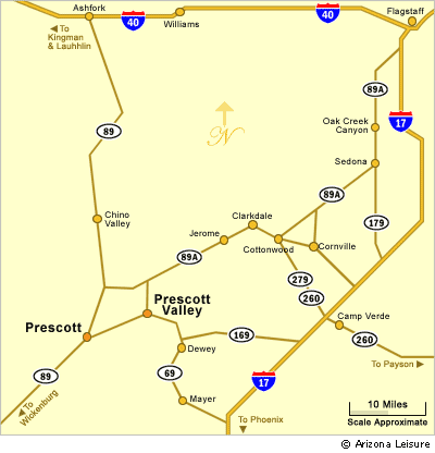
The Prescott / Prescott Valley Arizona area map highlights key highways, scenic routes, and nearby destinations that make this mountain region easily accessible from across the state. Located roughly 90 miles north of Phoenix, Prescott is primarily reached via State Route 69 through Prescott Valley or via the scenic State Route 89 from Wickenburg. Additional access routes such as State Route 89A connect Prescott to Sedona and northern Arizona, offering travelers breathtaking views through mountain passes, forests, and high desert landscapes. This map provides a helpful overview of the region’s layout, lakes, and major travel corridors.
Prescott is centrally located among some of Arizona’s most popular destinations, making it an ideal base for exploring the state’s diverse landscapes. Just a short drive away, visitors can explore Prescott Valley, known for events and shopping, or head north to Sedona for its famous red rock scenery and hiking trails. To the east, the historic mining town of Jerome offers unique shops and panoramic views, while outdoor lovers can visit Granite Dells and nearby lakes for boating, fishing, and camping. Prescott’s central location also places it within reach of Flagstaff, the Verde Valley, and even day trips to the Grand Canyon.
How To Get To Prescott
From Phoenix and Scottsdale. Prescott is located about 100 miles north of Phoenix and Scottsdale, AZ. Take Interstate 17 (Black Canyon Highway) North. Exit West on Highway 69 at Cordes Junction. Drive through Mayer, Dewey and Prescott Valley into to Prescott. You will also pass near Lynx Lake.
To help plan your visit, see our Prescott Average Temperature Chart.
Driving Distances To Prescott Arizona
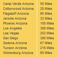
- Phoenix to Prescott: About 100 miles by way of Interstate 17 and State Route 69.
- Scottsdale to Prescott: About 100 to 115 miles depending on starting point and route.
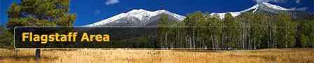
- Flagstaff to Prescott: About 95 to 100 miles depending on route.
- Sedona to Prescott: About 65 to 70 miles by way of scenic highways through central Arizona.
- Jerome to Prescott: About 35 miles, with scenic mountain driving along the route.
Major Highways Near Prescott
- State Route 69: The main route into Prescott from Interstate 17, passing through Prescott Valley.
- State Route 89: A scenic route connecting Prescott with Wickenburg and northern Arizona.
- State Route 89A: A winding scenic highway connecting Prescott with Jerome, Cottonwood, and Sedona.
- Interstate 17: The primary north-south freeway used by travelers coming from Phoenix or Flagstaff.
Nearby Towns and Attractions Around Prescott
- Prescott: Historic downtown, Whiskey Row, courthouse plaza, museums, lakes, and mountain recreation.
- Prescott Valley: A nearby community east of Prescott with shopping, events, and access from State Route 69.
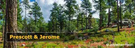
- Jerome: A historic hillside mining town known for shops, views, galleries, and scenic drives.
- Sedona: Famous for red rock scenery, hiking, photography, and Oak Creek Canyon.
- Granite Dells: A scenic area of rounded granite formations, trails, and lake views near Watson Lake.
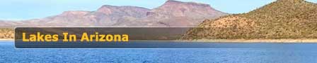
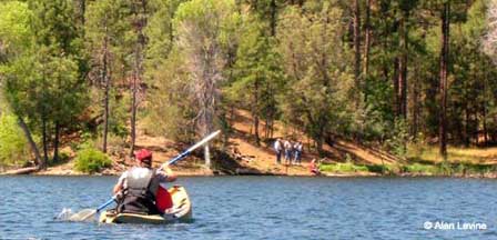
Prescott Area Lakes On The Map
- Watson Lake: Known for granite boulders, kayaking, hiking, and photography.
- Lynx Lake: A popular forest lake southeast of Prescott with fishing, camping, and hiking.
- Goldwater Lake: A scenic lake south of Prescott popular for picnicking, kayaking, and fishing.
- Willow Lake: Located near Granite Dells with trails, birding, and lake views.
Google Map of Prescott Arizona
Prescott Map FAQ
Where is Prescott Arizona located?
Prescott is located in central Arizona, northwest of Phoenix and southwest of Flagstaff, in the Bradshaw Mountains region.
How far is Prescott from Phoenix?
Prescott is about 100 miles north of Phoenix by way of Interstate 17 and State Route 69.
How far is Prescott from Flagstaff?
Prescott is about 95 to 100 miles from Flagstaff, depending on the route taken.
What highway goes to Prescott Arizona?
State Route 69 is the main highway into Prescott from Interstate 17, while State Routes 89 and 89A provide scenic access from other parts of Arizona.
Is Prescott near Sedona?
Yes, Prescott is about 65 to 70 miles from Sedona by way of scenic central Arizona routes.
What towns are near Prescott Arizona?
Nearby towns include Prescott Valley, Chino Valley, Dewey-Humboldt, Jerome, Cottonwood, and Sedona.
What lakes are near Prescott?
Nearby lakes include Watson Lake, Willow Lake, Lynx Lake, and Goldwater Lake.
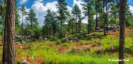
In The Pines Around Prescott
Prescott Arizona
Map & Directions
Prescott Arizona
Average Temperatures
About Prescott AZ
Jerome Area Map
Jerome Arizona
Lakes Nearby Prescott
Watson Lake
Goldwater Lake
Lynx Lake
Willow Lake
Things To Do
Camping In Prescott
Prescott Lakes
Prescott Attractions
Prescott Golf Courses
Prescott Hiking
Prescott Museums
Nearby Camping
White Spar Campground
Lynx Lake Campground
Granite Group Camping
Hilltop Campground
Lower Wolf Creek
Upper Wolf Creek
Where To Stay
Prescott Cabin Rentals
Bed & Breakfast
Prescott RV Parks
Prescott Articles
History Lives In Prescott
Whiskey Row