Panoramic Prescott Arizona, A Hiking, Biking & Horseback Riding Paradise.

What more could you ask for in an outdoor getaway from big city life? Cool refreshing comfortable temperature year-round. Fresh summer air, mild autumns with changing colors and springtime wildflowers. Surrounded by forested mountains of pine and blue spruce, Prescott is conveniently located less than a two-hour drive from Phoenix. See our Prescott area map.
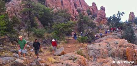
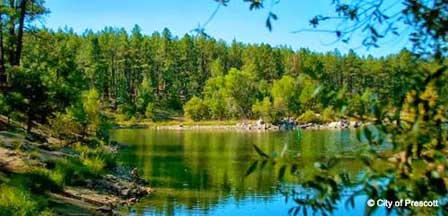
In Prescott you’ll find three lakes each contrastingly different than the other. Protruding boulders of granite rise from the Dells, the waters of Watson Lake are sky blue and Lynx Lake is heavily treed. Prescott has a scenic view in every direction. Located in the heart of the Prescott National Forest, the area features over 450 miles of multi-use trails for hiking, mountain biking and horseback riding.

There are numerous trails within a short twenty-minute drive from downtown Prescott, Arizona. Most charge a very nominal fee, but the outdoor enjoyment of great scenery as you harmonize with nature is well worth a couple of dollars. Here is a sampling of some of the most popular trails.
Thumb Butte Trail 33
The trail is limited only to hiking. It is Prescott’s most popular hiking trail located just 3 miles from downtown Prescott. The 1.75 mile loop is paved and rated moderate difficulty. The trail loop begins moderately steep and levels more gently as it passes through forested canyon. The views at the top of Prescott, the Bradshaw Mountains and Mingus Mountain are spectacular. On a clear day you can see the San Francisco Peaks north of Flagstaff, Arizona.
Directions. Head west on Gurly Street a few miles as it changes its name to Thumb Butte Road. Continue northwest to the trailhead parking area.
Forest Trail 320
Forest Trail is an easy trail in a gorgeous section of the Prescott National Forest. At one point the trails enters a lovely open area which is the future site of a Nature Center. Continue on a trail up the hill to reach Lynx Lake Road at the north end of the lake where you will find a picnic area, boat rentals, and a store. If you take the side trail back at the future Nature Center, you will follow a small wash to Lynx Creek. At this point, the area has large boulders and a small flume. It is well worth the hike.
Directions. Follow directions for the Lynx Creek Ruin trail and park at the trail head.
Goldwater Lake
This is fee area. The park at Goldwater has a picnic area, fishing, canoeing, and facilities. There is also a nice trail around the lake to the far side of the dam. Return via the same trail.
Directions. Drive up Senator Highway, which begins on Mount Vernon St, about 4 miles to the entrance to the lake. Turn right and park in the parking lot at the end of the road.
Granite Basin Lake
There is a minimal fee per car. Hike on the trail as far as you desire and return the same way. The trail leads up onto Granite Mountain but the first part is fairly level. Picnic facilities may be found at the entrance to the park.
Directions. Take Montezuma Street to Whipple Street to Iron Springs Road (these are actually the same road; it just changes names). Continue out Iron Springs Road about 4 miles to the Granite Basin turnoff. Proceed on this road about 4 miles to Granite Basin Lake. Follow the road around to the right to the trail head.
Groom Creek Handicap Trail
This is an easy and pleasant, scenic hike. Picnic tables are available.
Directions. Follow directions to Goldwater Lake and continue on Senator Highway through Groom Creek to the old schoolhouse. Park in the parking area and follow the asphalt trail into the forest
Groom Creek Loop Trail 384 (Wolf Creek)
Hiking, biking and motorized vehicles less than 40 inches wide are permitted. This 6-mile trail loop is rated easy with only a gradual 500-foot elevation gain and takes about 3.5 hours to hike the loop. Maverick Mountain and Mt. Tritle provide a gorgeous backdrop as the trail winds through lush vegetation along the upper basin of the Hassayampa River.
To Get There. From downtown Prescott, head south on Mount Vernon Avenue approximately 6 miles to Groom Creek. Just beyond Groom Creek turn right on the dirt road to Wolf Creek. Just beyond Groom Creek turn right on the dirt road to Wolf Creek campgrounds. Trail 384 crosses the road within 0.4 miles.
Prescott Peavine Trail
Trail This is an easy trail that permits hiking, biking and horseback riding. The Peavine Trail winds the historical route of the Santa Fe Railroad covering lushly beautiful scenery. The hike is about a 9.2 mile round-trip through Granite Dells, above Watson Lake and towards open rangelands where wild antelope herds are often seen. You can shorten the hiking distance by leaving your auto at Highway 89A cutting the hike to about 4.6 miles. Great views of Watson Lake and Granite Dells.
Directions. Take Gurley Street east from downtown Prescott to the Highway 89/69 intersection. Take 89A north for 1.1 miles to Sun Dog Ranch Road and turn right. Continue north about 1.5 miles where a road turns left opposite of the Animal Control Headquarters. The hiking trail is just 0.1 mile from there.
Little Granite Mountain Trail 37
This is a moderate hike that takes about 1.5 hours. Hiking, horseback riding and non-motorized bicycling is permitted on this trail that offers striking panoramic views of Skull Valley, Sugarloaf Mountain and the western-end of the Sierra Prietas. For a loop hike, drop your vehicle at Granite Basin Lake (great canoeing). Take trail 37 from Iron Springs trailhead to the Clark Spring Trail turnoff, which leads to Granite Basin Lake.
Directions. Head north from downtown Prescott on Montezuma which will turn into Whipple Street to the Miller Valley, Whipple Creek and Iron Springs road intersection. Continue straight on Iron Springs about 6.2 miles. The trailhead is 3.2 miles west of the turnoff to Granite Basin Lake.
Lynx Creek Ruin Trail
This is an easy hike of about 0.75 miles. At the end of the trail, there is an interpretive area overlooking a prehistoric ruin of ancient Indian culture. Horseback riding and motorized vehicles are not permitted. The views are great.
Directions. Take Route 69 to Walker Road. Turn left and proceed about 5 miles to the north end of Lynx Lake. Travel another mile to the entrance to the south end of the lake.
Pioneer Park
Hike on trail as far as you like and return the same way. Picnic facilities may be found off Willow Creek Road at Willow Springs Lake Park or Heritage Park by returning down Commerce Drive and turning left. The parks are just up the road.
Directions. Go north on Route 89 to the first stop light. Turn left onto Willow Lake Road. Turn right on Will Creek Road to Commerce Drive. Turn left on Commerce Drive to the top of the hill. Park at trail head.
Salida Gulch
At Lynx Creek near Lynx Lake. Great views and an easy hike. Look for a rock panel on the left of the trail where you will see several petroglyphs carved into the rocks by prehistoric Native American Indians.
Directions. Follow directions to the Lynx Creek Ruin Road. The road is a bit rough but passable in a passenger car. At the Forest Service fence near the creek, about a mile from Walker Road, park in the open space. Cross the creek and follow the trail on the south side of Lynx Creek for about 1 mile into Salida Gulch.
Enjoy Hiking in Prescott
Hotel Convenience
If you plan an extended overnight stay in the Prescott area, click here for the best discount rates on Prescott Hotels with quick and secure online reservations. Or consider a wide variety of bed and breakfasts in Prescott AZ.
Helpful Links
Prescott National Forest
Prescott Hiking Club
In The Pines Around Prescott
Prescott Arizona
Map & Directions
Prescott Arizona
Average Temperatures
About Prescott AZ
Prescott Pictures
Jerome Area Map
Jerome Arizona
Lakes Nearby Prescott
Watson Lake
Goldwater Lake
Lynx Lake
Willow Lake
Things To Do
Camping In Prescott
Prescott Lakes
Prescott Attractions
Prescott Golf Courses
Prescott Hiking
Horseback Riding
Prescott Museums
Nearby Camping
White Spar Campground
Lynx Lake Campground
Granite Group Camping
Hilltop Campground
Yavapai Campground
Lower Wolf Creek
Upper Wolf Creek
Where To Stay
Prescott Cabin Rentals
Bed & Breakfast
Prescott RV Parks
Prescott Articles
History Lives In Prescott
Whiskey Row


