Papago Park
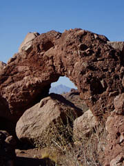
Papago Park covers 1,200 acres of park recreation and extends to the cities of Phoenix, Tempe and Scottsdale AZ. It is not the largest park in the city of Phoenix, that distinction belongs to South Mountain Park. But Papago features the widest variety of outdoor fun and is home to some of the most visited attractions in the Phoenix area making it a popular destination for both residents and vacationers. Due to its urban location, it is also a very convenient destination for travelers staying at Phoenix area hotels and resorts.
The Park is open from 5:00 AM to 11:00 PM daily.
A Storied History
Ancient Hohokam Indians graced this area thousands of years ago and gifted us with evidence of their existence. Modern day history began in 1879 when the Pagago Park area was designated as an Indian Reservation fo the Maricopa and Pima Indian Tribes. In 1914 the area was federally declared as "Papago Saguaro National Monument" until the name was abolished in 1932.
During World War II, the area housed German prisoners of war from 1943 to 1946. After thewar, the prisoner camp was converted to a Veterans Administration Hospital from 1947 to 1951. It became the District Headquarters for Arizona's largest Army Reserve Unit from 1953 to 1966. In fact, today an "off-limits" portion of Papago Park is used for Arizona National Guard training.
Hole In The Rock
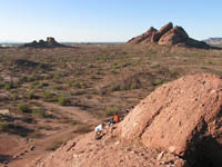
The hole-in-the-rock is the most prominent icon in Papago Park and carries evidence that the prehistoric Hohokam Indians settled this area thousands of years ago. The red butte was created 6 to 15 million years ago and naturally formed with a series of openings caused by erosion. The openings and "chamber" (hole) near the butte's summit are easily accessed from the rear via a smooth, but somewhat steep path. Those that trek to the chamber hole-in-the-rock are rewarded with great views across the city.
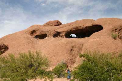
The ancient Hohokam People noticed that a hole in the ceiling in the chamber creates a ray of light that changes positions on the chamber's floor during the year depending upon seasonal movements of the sun. They marked the occurrence of the summer solstice by grinding a bedrock "metate slick" at the location where the ray of light falls during the day at noontime. The winter solstice is marked by the ray of light interaction with a natural seam in the bedrock. They also marked the equinoxes, the seasonal halfway point between the summer and winter solstices with a bedrock metate slick. The boulders near the hole-in-the-rock appear to provide other solstice and equinox markers. This is evidence of the cultural accomplishments of the ancient Hohokam people.
Hiking, Biking, Picnicking, Archery and Golfing
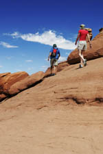
The beauty of red sandstone buttes are iconic to the Valley of the Sun and represent a plethora of such diverse family fun that can be enjoyed over and over again. Picnic in the shadows of Hole-In-The-Rock next to three fishing ponds. Barbecue on ramada covered cooking grills.Hike one of its many hiking trails with easy to moderate difficulty that is relatively safe for children. They are easy treks with little elevation gain and are biking friendly. So whenever a resident or traveler yearns for a quick,easy hike that is conveniently located, Papago Park is an ideal spot.
Hiking, Biking Trails - West of Galvin Parkway
The parking lot is on the west end of Papago Park Drive. You'll find a drinking fountain, bike rack and ramada covered picnic tables that cannot be reserved. There are no restrooms and no through traffic.
West Park Trail (Wheelchair Accessible)
- 1.2 Miles (2nd half can be difficult for wheelchairs with above 5% grade)
- Minimal
- Easy
West Loop Trail
- 4 Miles
- 50 Feet
- Easy
Hiking, Biking Trails - East of Galvin Parkway
This is the main part of the park. There are restroom, drinking fountains, picnic ramadas and fishing lagoons.
Nature Trail
- 0.25 Mile
- None
- Easy
Hole-In-The-Rock Trail
- 0.10 Mile
- 200 Feet
- Easy
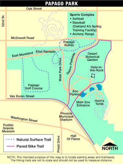
Hiking & Biking Trail Map
Fishing At Papago Park
There are three urban fishing ponds at Papago Park that are a combined six acres of water surface. Boating, swimming, wading and glass containers are not permitted. An urban fishing license is required to test your skill at catching Largemouth Bass, Rainbow Trout, Crappie, Channel Catfish, Tilapia, White Amur, Bluegill, Sunfish and Carp. There is a daily bag possession limit of 2 catfish, 2 trout, 1 bass (13 inch minimum), and 1 white amur (30 inch minimum). There is no limit on tilapia or carp. An alcoholic beverage permit is required. Call (602) 256-3220 for more information.
Other Attractions Within Papago Park
Papago Park features unique landscape, family outdoor recreation, fishing ponds, picnic facilities and nice hiking trails, but it is also home to some popular Phoenix attractions that include the Phoenix Zoo, one of the nations largest, and the Phoenix Desert Botanical Garden. It is also home to the Arizona Historical Society Museum and Hunt's Tomb, the tomb of George W.P. Hunt (1859-1934), Arizona's first governor. The Papago Golf Course is also located within the park.
More Information
- Papago Park Website
- Van Buren Street & Galvin Parkway
- Phoenix, Arizona
- (602) 256-3220
Related Phoenix Interest
Phoenix Arizona
Camelback Mountain
Desert Botanical Garden
Greater Phoenix Map
Greater Phoenix Things To Do
Japanese Friendship Garden
Mystery Castle
Hiking Papago Park
Phoenix Area Attractions
Phoenix Area Museums
Phoenix Arts & Theatre
Phoenix Bed & Breakfasts
Phoenix Boat Rentals
Phoenix Boat Tours
Phoenix Dude Ranches
Phoenix Events & Festivals
Phoenix Fishing Guides
Phoenix Grand Canyon Tours
Phoenix Horseback Riding
Phoenix Restaurants
Phoenix To South Rim
Phoenix Weather Info
Phoenix Zoo
Piestewa Peak Hiking
Rawhide Western Town
Roosevelt Lake Map & Directions
South Mountain Park
Metro Phoenix


